Happy Sunday, July 6, 2025, South Florida!
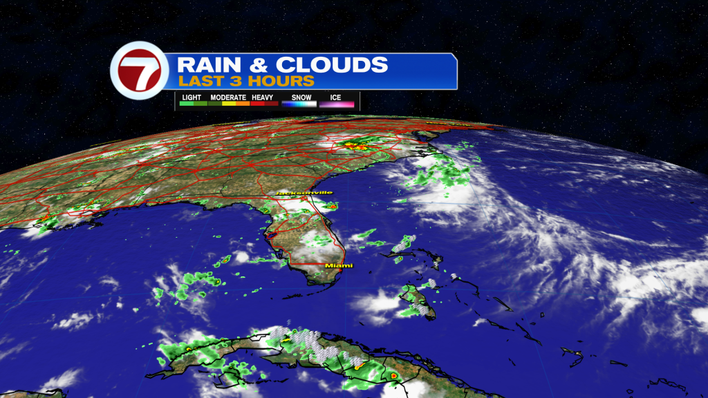
Hopefully everyone had a wonderful and safe holiday weekend. South Florida has been stuck in a stormy rut for days now but there is a light at the end of the tunnel after today. A front was stalled over the state and a disturbance developed along that front just a few days ago. Well, that eventually spun a tropical system which then became Tropical Storm Chantal. Chantal made landfall in South Carolina earlier today but South Florida has been stuck in the tail of moisture associated with the tropical storm. This is why it has been so unsettled this weekend. This afternoon was no different as we saw rounds of showers and storms with late day sunshine in between.
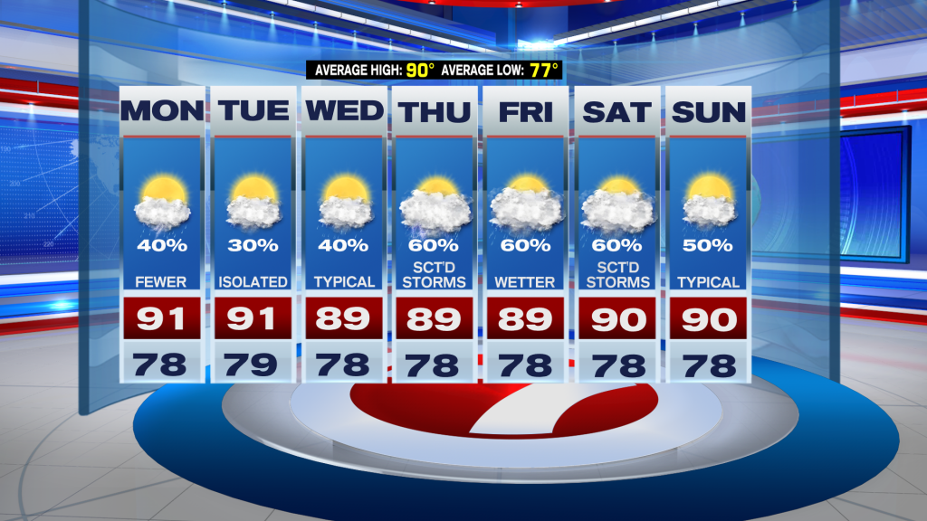
The start of the work week will bring improving conditions for South Florida as Chantal continues to weaken over land and its associated tail of moisture is finally cut off. Monday looks to be a transitional day as we move to a more typical weather pattern across the area. While a few showers and storms will still be possible, overall the coverage will be less widespread to start the work week. Monday high temperatures will be reaching into the low 90s with many areas seeing the mid 90s as well.
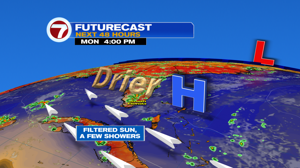
Looking ahead, the first half of the work week will bring better weather for South Florida as drier air begins to move in and high pressure once again builds into the region. This will help lower our rain and storm chances through the first half of the work week. Midweek, we will be watching an upper level low approaching the region so South Florida will likely see higher rain and storm chances through the second half of the work week. The good news is that our wind pattern will remain off the water. So even though we will see higher rain chances, South Florida will remain under a typical summer-like weather pattern, which means rain & storms will eventually shift farther inland away from our East Coast metro areas each afternoon.
Have a great week!
Erika Delgado
Meteorologist
WSVN / Channel 7 News