Happy Sunday, July 13, 2025, South Florida!
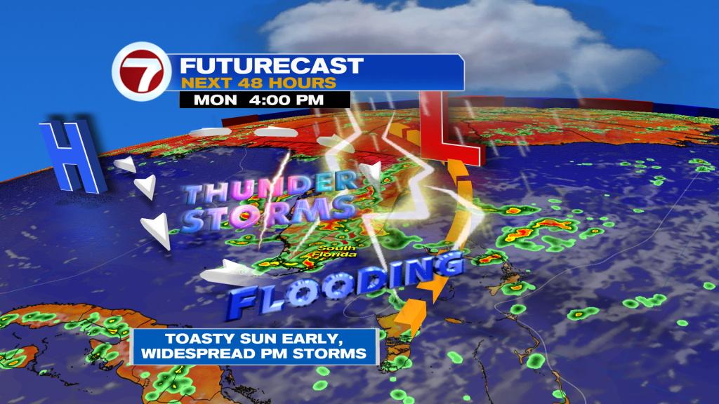
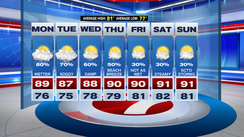
Hopefully everyone had a great weekend despite the showers and storms that South Florida endured both days. Several rounds of rain and storms continued through the weekend but at least it wasn’t a complete washout. South Florida did see a few peeks of sun along with some dry time here and there. Unfortunately, it looks like South Florida is about to enter a wetter weather pattern to start the work week so be sure to have that rain gear ready just in case.
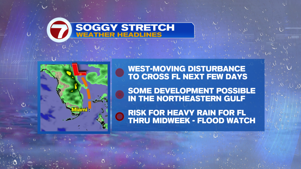
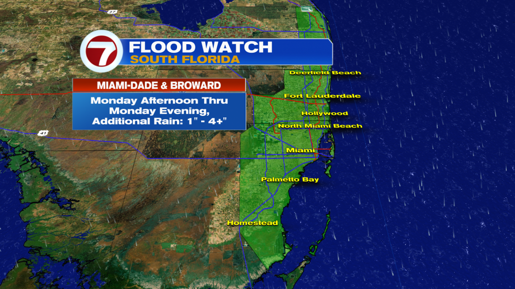
We will be watching a disturbance off of the coast of the southeastern U.S. that is forecast to cross Florida through the next few days. As it moves westward across the state, the risk for heavy rain and thunderstorms will remain across the region through at least the middle of the work week. Flooding will continue to be a concern, especially Monday afternoon and evening as we could see the potential for heavy rain. As a matter of fact, South Florida has been placed on a level two of four for the risk for heavy rainfall and street flooding Monday into Monday night.
Because of the heavy rainfall potential, flooding will continue to be the main concern for mainland portions of South Florida throughout the day on Monday. A flood watch has now been issued to include Miami-Dade and Broward Counties beginning Monday afternoon through Monday evening for the potential of very heavy rainfall that could lead to street flooding. Up to 1 to 4 inches of rain will be possible for portions of South Florida, however, higher amounts are also possible.
Looking ahead, the above mentioned disturbance will eventually drift westward into the Northeastern Gulf and that is when the National Hurricane Center is saying that some development will be possible. Although chances for development remain on the lower end for now, the forecast for South Florida will remain the same regardless of development. The risk for heavy rainfall which could lead to flooding will be the main concern through the middle of the work week. As the disturbance continues to drift farther into the Gulf waters, conditions will gradually improve for much of the state of Florida through the second half of the work week. High-pressure will once again build into the region, bringing back a beach breeze across the state, which will bring back a typical weather pattern for our area. This means that showers and storms will be focused across interior sections of South Florida and along the Gulf coast each afternoon. This pattern sticks around through next weekend!
Have a great week. Keep that rain gear close!
Erika Delgado
Meteorologist
WSVN / Channel 7 News